
A practical guide to the Nagarkot–Changunarayan hike — 15.6km downhill through Tamang villages and forest to a 4th-century UNESCO temple. No guide needed, no trekking permit required. Here's exactly how to do it independently.
Most people who do this hike book it through a tour operator in Thamel and pay NPR 3,000 to 5,000 for a guide to lead them down a trail that is mostly downhill and clearly marked.
You do not need to do that. The trail has direction boards at the key junctions, the descent is gradual, and the whole thing takes 3 to 4 hours. This guide tells you exactly what to expect so you can do it on your own.
Here is what you will find below:
Trail distance, elevation, and honest difficulty level
The route step by step from Nagarkot to Changunarayan, including which villages you pass
How to get back to Kathmandu after you finish
Trail Facts at a Glance
Before committing to this hike, here are the key numbers:
The hike is almost entirely downhill from Nagarkot to Changunarayan, which means it is far easier on the legs than most trails near Kathmandu. Most first-time hikers with no trekking experience complete it without any problems.
How to Get to the Starting Point
The hike starts from the Nagarkot area, which is 32 kilometers east of Kathmandu. There are two ways to get there.
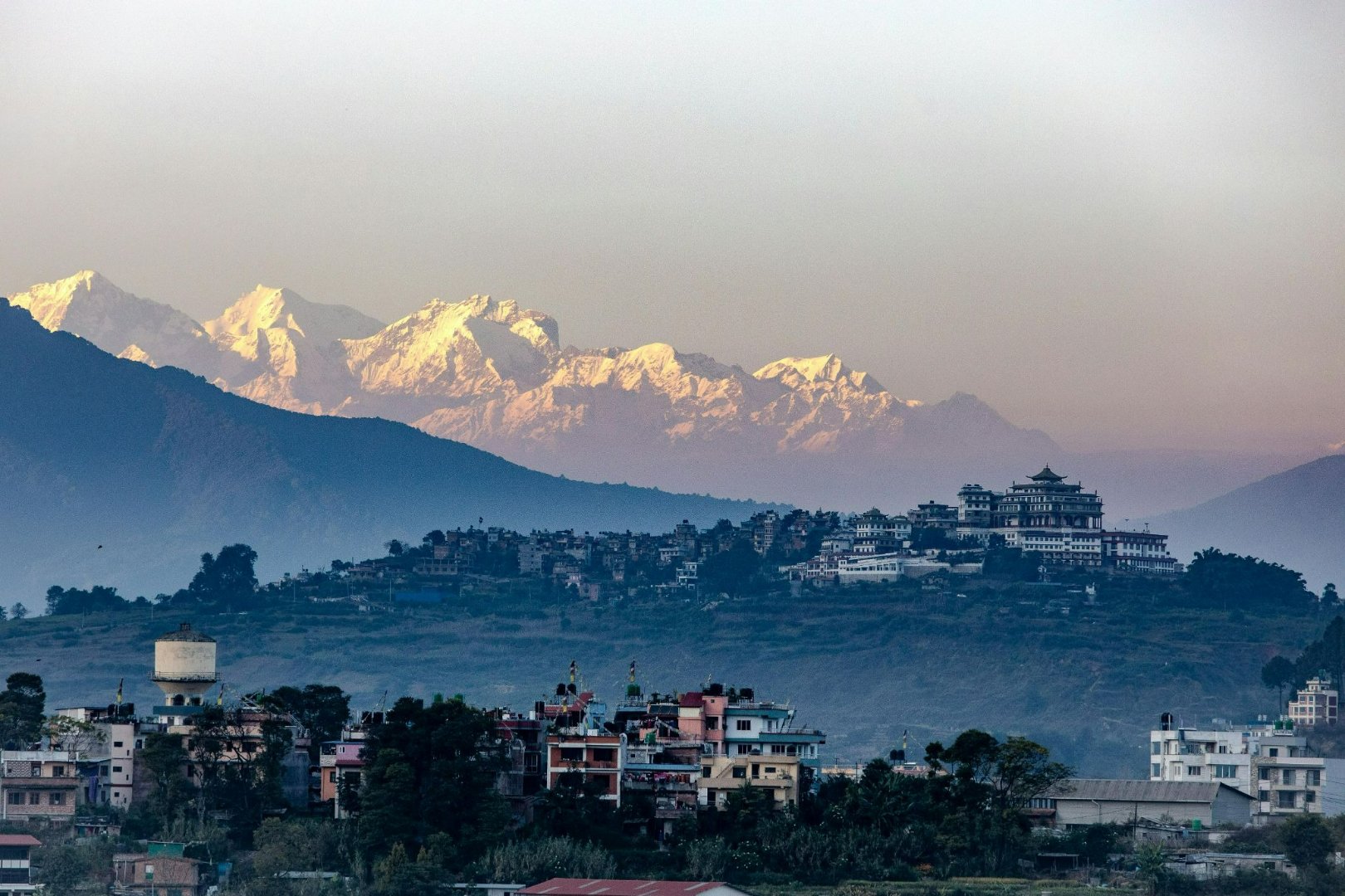
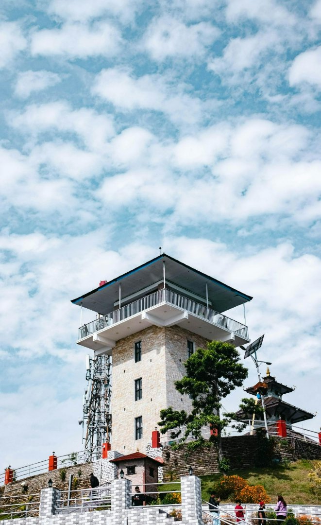
If you are doing a day trip from Kathmandu, a private car or taxi from Thamel costs NPR 4,000 to 6,000 for a drop-off at Nagarkot. Ask your driver to take you to the Nagarkot View Tower road rather than just the main village. From the tower area, the trail south toward Telkot is where the Changunarayan hike begins.
If you stay the night in Nagarkot, you can catch the sunrise before you start and begin the hike at around 7:30 to 8:00am once the sun is up and you have had breakfast. This is the better option because you start the trail with energy and full daylight ahead of you. Homestays near the trailhead run around USD 25 to 50 per night with meals included, and most hosts know the trail well and can tell you about current conditions before you leave.
The Trail Route: What You Pass and When
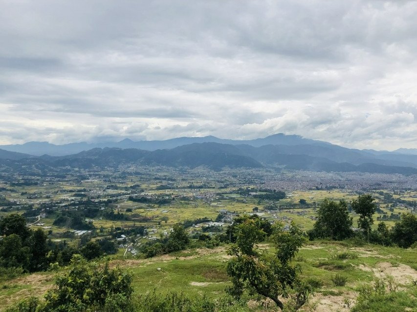
The trail from Nagarkot to Changunarayan divides naturally into two halves. The first half takes you through villages and farmland. The second half drops into the forest before arriving at the temple.
Nagarkot to Telkot Village (First Half)
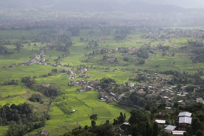
The hike begins from the road south of the Nagarkot View Tower. You follow the main ridge road for the first kilometer, then the trail branches left onto a footpath that descends through open hillside with wide views of the Bhaktapur Valley below.
The first significant stop is Tusal village, a small Tamang settlement about 45 minutes from the start. The houses here are built in the traditional Tamang style, with stone walls and small vegetable plots around the front. There is usually a tea stall open by 8am where you can stop for a glass of sweet milk tea and rest your knees on the descent.
From Tusal, the trail continues down through terraced rice and wheat fields to Telkot village, which sits about 1.5 to 2 hours from the start. Telkot is the largest village on the route and the main junction point on the trail. A small market area has a few restaurants where you can eat a proper dal bhat meal before the second half of the hike. Most organized tours stop here for lunch, which means if you arrive independently you will find hot food without any prior arrangement.
The trail through the first half is well-worn and easy to follow. At Telkot there are direction boards pointing toward Changunarayan. If you are ever unsure, ask a local. Most villagers along this route are used to hikers and will point you in the right direction.
Telkot to Changunarayan Temple (Second Half)
After Telkot, the character of the trail changes. The farmland gives way to a forested ridge, and the path narrows into a proper footpath through pine and rhododendron trees. The views here are less open but the shade is welcome, especially if you are hiking in April when temperatures start climbing by mid-morning.
This section takes around 1 to 1.5 hours. The trail passes through a smaller Newari village before the final approach to Changunarayan, which sits on its own hilltop above the surrounding valley. The last 20 minutes involves a short climb up to the temple platform, the only real uphill section of the whole hike.
Changunarayan Temple: What to See When You Arrive
Changunarayan Temple is a UNESCO World Heritage Site and one of the oldest Hindu temples in Nepal, built in the 4th to 5th century during the Licchavi period. An inscription from King Manadeva dated 464 AD is carved into a stone pillar in the temple courtyard and is considered the oldest written record in Nepal's history.
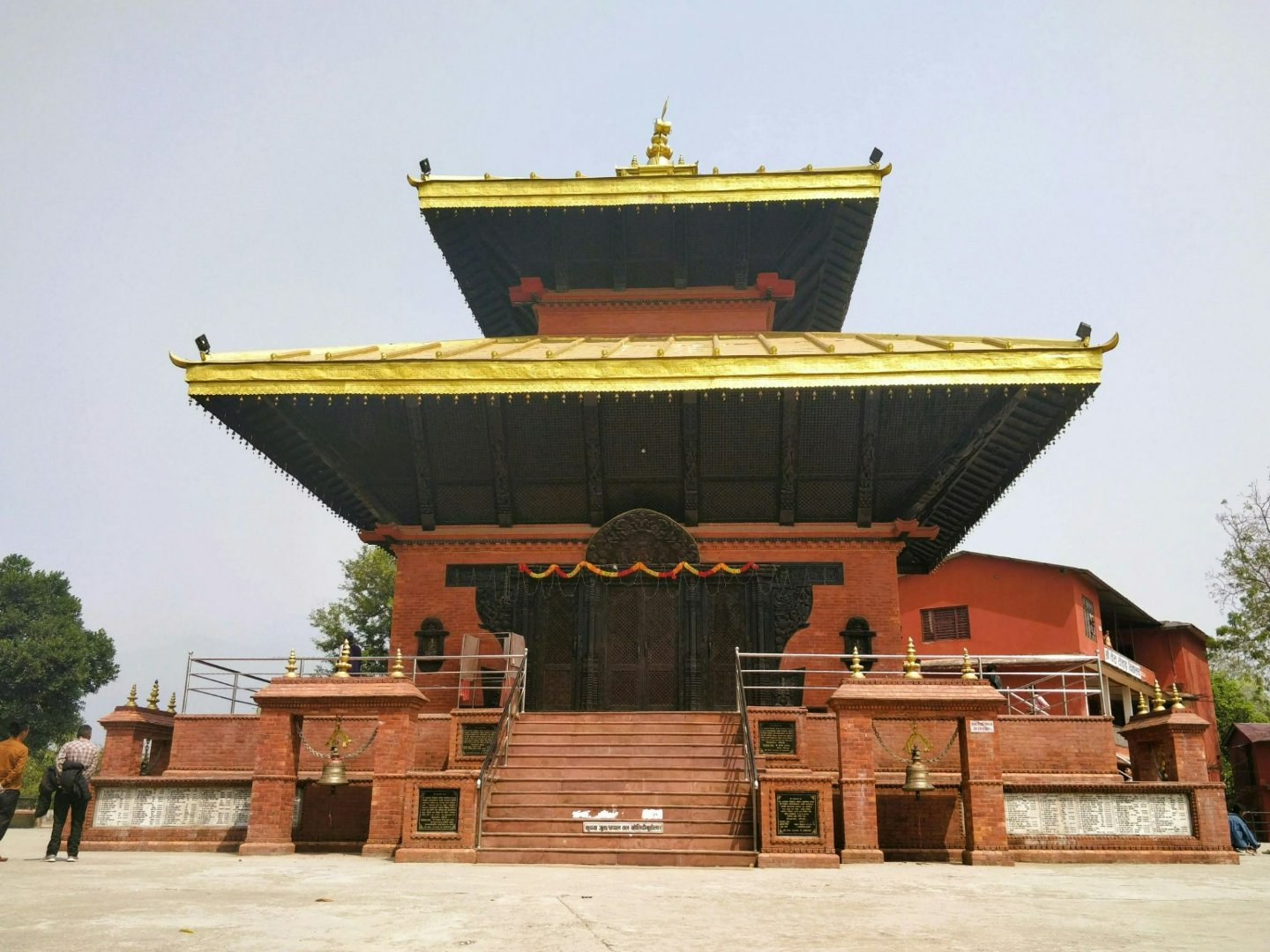
The temple is dedicated to Vishnu and sits on a hilltop surrounded by a small traditional village. A few things worth seeing before you leave:
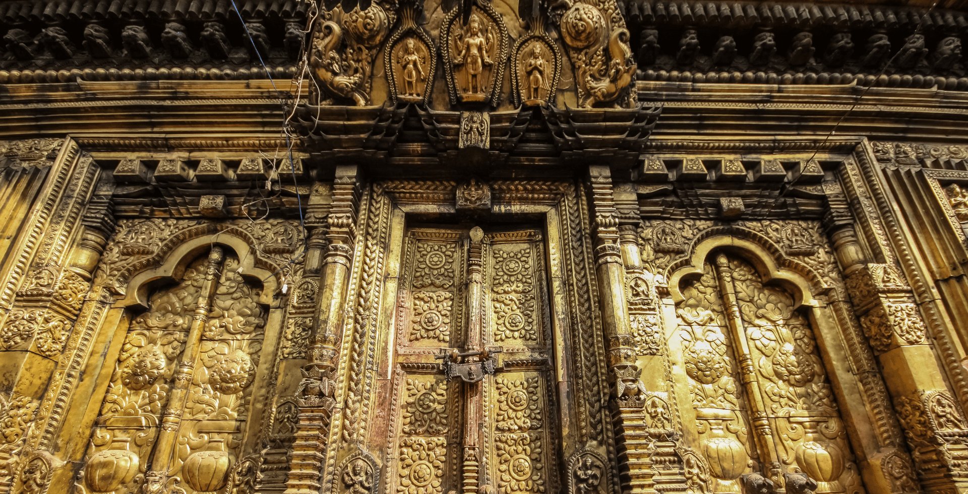
The Garuda statue in front of the main temple entrance, a large stone sculpture of the eagle deity that serves as Vishnu's vehicle
The carved wooden windows and doorways on the temple facade, which show detailed figures of Hindu deities and date back several hundred years
Changunarayan Museum at the entrance to the village, which holds ancient coins, stone sculptures, and manuscripts from the Licchavi and Malla periods
The temple courtyard itself, where local priests and worshippers go about their daily rituals largely undisturbed by tourism
Entry to the temple complex costs NPR 300 for foreign visitors. Allow at least 45 minutes to an hour here before arranging your return to Kathmandu.
How to Get Back to Kathmandu After the Hike
This is the part most blogs skip entirely. Changunarayan sits above the town of Bhaktapur, and getting back to Kathmandu takes a little planning.
By local microbus or tempo: Walk 20 to 30 minutes downhill from Changunarayan temple to the main Bhaktapur road below. From there, local microbuses and tempos run regularly to Kathmandu's Ratna Park bus terminal for around NPR 30 to 50. The journey takes 45 to 60 minutes depending on traffic.
By taxi from Changunarayan: A taxi from the temple to Thamel costs around NPR 1,000 to 1,500 and takes 30 to 45 minutes. You can usually find waiting taxis near the entrance to Changunarayan village. If none are available, ask at one of the tea shops and they will call one for you.
By pre-arranged pickup: If you are staying at a homestay in Nagarkot, you can ask your host to arrange a driver to pick you up from Changunarayan at a set time. This is the most comfortable option and typically costs NPR 3,000 to 4,000 for the car.
What to Bring
The trail is easy but the descent puts pressure on your knees over 15 kilometers. A few things that make a real difference:
Shoes with grip. The trail is smooth in dry weather but muddy sections near the villages get slippery after rain. Trainers work fine in dry conditions. Hiking shoes are better for wet days.
Water and snacks. There are tea stalls in Tusal and food options in Telkot, but carry at least one litre of water for the first half before you reach the village.
A light layer for the morning. If you start at 7:30am after the sunrise, the air at 2,175 meters is still cool. By Telkot you will not need it.
Cash for the Changunarayan entry fee. NPR 300, payable at the gate. No card machine is available.
Your phone with a downloaded offline map. Google Maps works for the Nagarkot to Telkot section. For the forest trail to Changunarayan, the trail is marked with direction boards but an offline map gives you confidence at the junctions.
Final Thoughts
This is one of the most practical day hikes available from Kathmandu. It combines a mountain viewpoint, two hours of village walking, a stretch of forest, and a 4th century UNESCO temple, all without needing a guide or a trekking permit.
The whole day, including transport, the hike, entry fees, lunch at Telkot, and a taxi back to Kathmandu, costs around NPR 3,000 to 5,000 per person when done independently. That is the same price most tour operators charge for the guide alone.
If you want to stay the night before the hike and start from the ridge at sunrise rather than driving up from Kathmandu at 4am, browse homestays at Nepal Homestays.
FAQ: Nagarkot to Changunarayan Hike
Do I need a guide for the Nagarkot to Changunarayan hike?
No. The trail has direction boards at the main junctions, the route through the villages is well-worn, and locals along the way are used to helping hikers who are unsure of the path. If you are comfortable following a trail and asking occasional directions, you do not need a paid guide.
How long does the hike take?
Most walkers complete the trail in 3 to 4 hours at a relaxed pace. Add 1 hour for breakfast in Nagarkot before you start, 30 to 45 minutes for lunch at Telkot, and 45 to 60 minutes at Changunarayan Temple. A full day trip from Kathmandu including transport takes 7 to 9 hours total.
Is this hike suitable for beginners?
Yes. The trail is almost entirely downhill and the terrain is not technical. People of moderate fitness with no previous hiking experience complete it regularly. The only uphill section is the final 20-minute climb to the Changunarayan temple platform.
What is the best time of year to do this hike?
October to April gives the best trail conditions and the clearest mountain views from Nagarkot before the hike begins. December to February is cold in the morning at Nagarkot but the views are exceptional. Avoid June to August when monsoon rain makes the trail muddy and mountain views are largely blocked by cloud.
Can I combine the Nagarkot sunrise with this hike?
Yes, and it is the most popular way to do it. Wake up early, watch the sunrise from the Nagarkot View Tower, have breakfast in the village, and start the hike at around 8:00am. You arrive at Changunarayan in the early afternoon with enough time to explore the temple and catch a bus or taxi back to Kathmandu before evening.
Company Admin
Travel writer sharing authentic stories and experiences from Nepal's beautiful homestays.